
GEO4X Pricing, Plans & Geospatial Workflow Fit
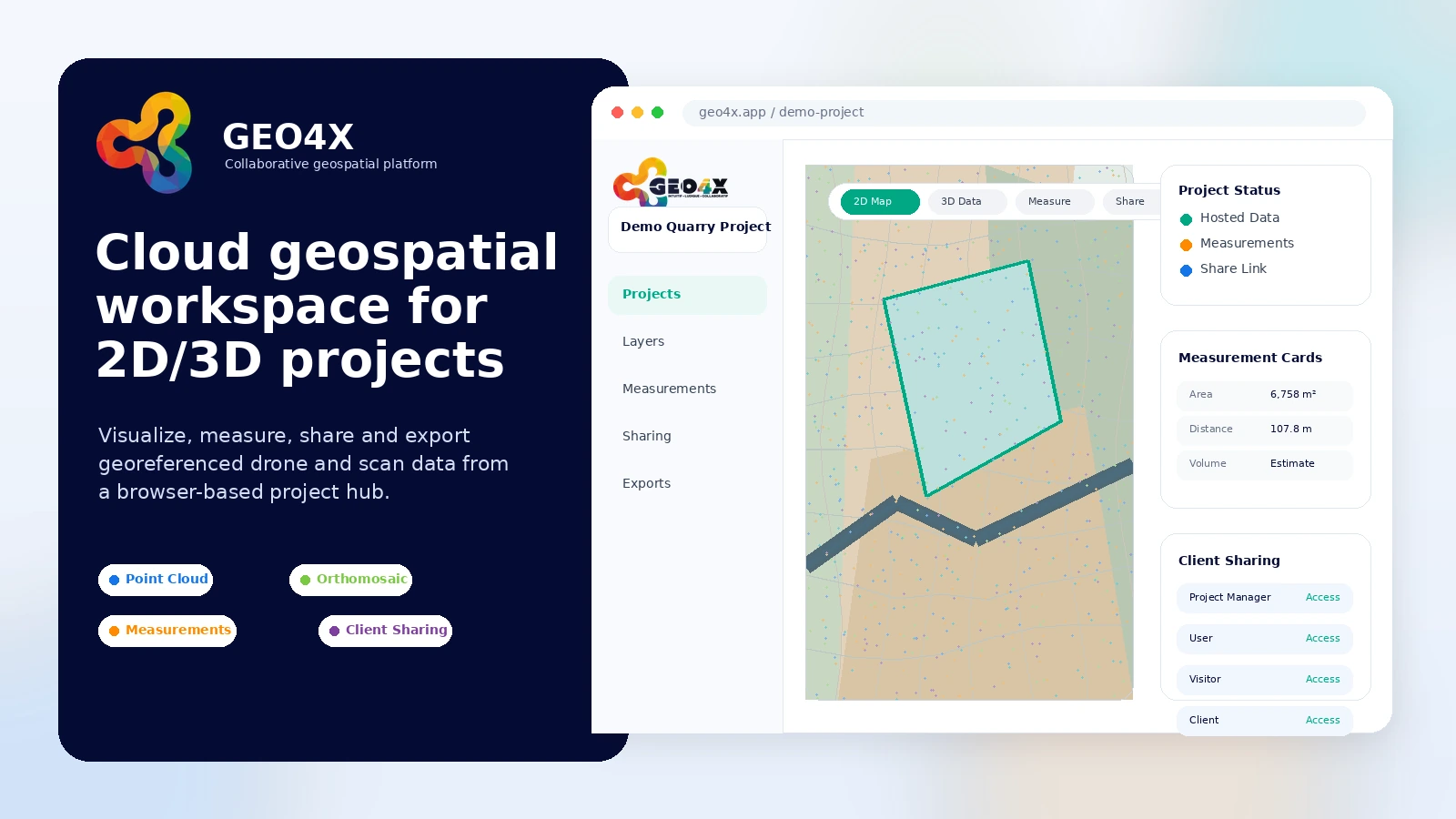
GEO4X is a cloud workspace for visualizing, sharing, measuring, and organizing 2D and 3D geospatial data. It is best read as a collaboration layer for drone mapping, photogrammetry, point clouds, orthomosaics, elevation models, inspections, and project handoff, not as a generic business SaaS app.
Fit → price → checkout
Use these routes after the official-site check: coupon first, review for fit, compare if unsure.
GEO4X pricing snapshot
Fast commercial checks before pricing, coupons, or a deeper review.
GEO4X product tour
The visual tour should focus on how GEO4X turns heavy geospatial files into a shared browser workspace: view data, measure, manage access, and decide whether the paid plan is worth it for real field or client work.
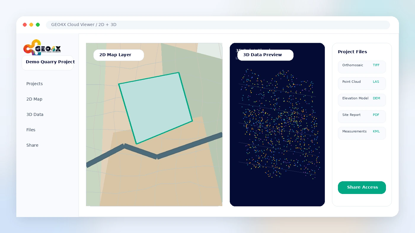
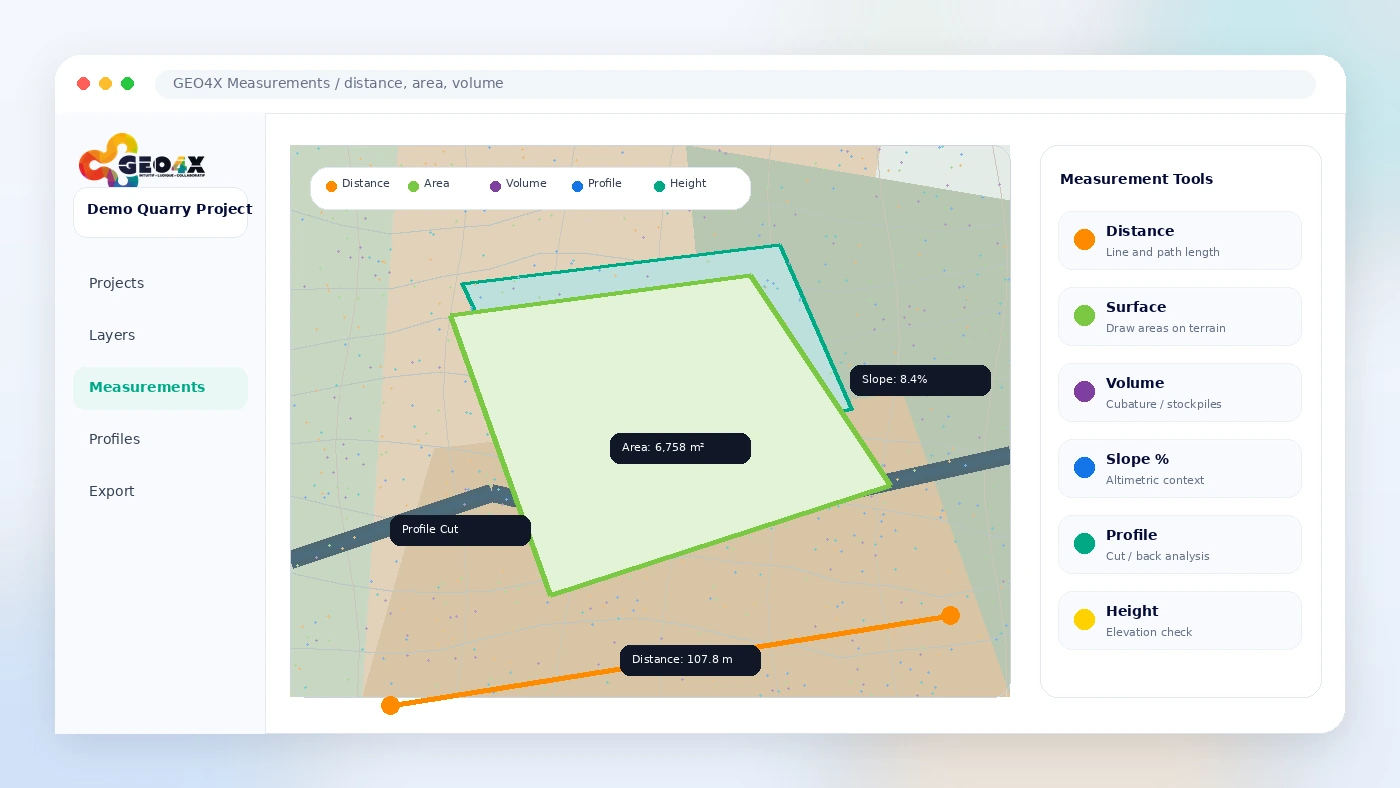
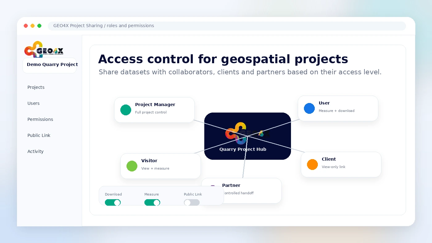
GEO4X should be evaluated as a geospatial project workspace. The buying question is not whether it has a nice cloud interface; the real question is whether it helps your team and clients handle large drone, mapping, point cloud, or inspection data with fewer handoff problems.
What GEO4X actually does
GEO4X gives teams a cloud place to visualize, measure, share, and host georeferenced 2D and 3D data. That includes formats and outputs commonly used in drone mapping and surveying workflows, such as orthomosaics, digital elevation models, point clouds, reports, documents, and related project files. It is a better fit for operational teams than for casual users who only want a folder of downloadable images.
- View 2D and 3D geospatial data in a browser
- Measure distance, area, volume, profile, slope, and related project values
- Share project access with collaborators, clients, and partners
- Upload or download project files, reports, and supporting documents
Pricing and plan fit
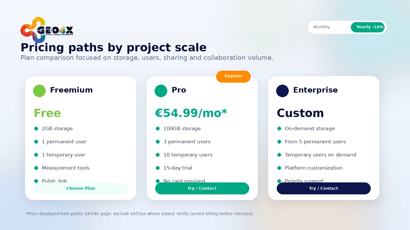
The public pricing path is clear enough to create a useful first decision. Freemium is the safest entry point, Pro is the realistic paid evaluation path, and Enterprise is for teams that need extra storage, customization, priority support, custom-built features, or bank transfer. The Pro price is public, but buyers should still confirm tax, annual billing, renewal, and exact storage or user requirements before checkout.
- Freemium includes 2GB storage and basic sharing
- Pro lists 100GB storage, more permanent users, and temporary users
- Enterprise is custom for larger or branded deployments
- Annual billing is shown as a savings path
Demo and video path before uploading real data
GEO4X provides public demos that can be opened from a browser, which is useful before uploading sensitive project files. Watch the product walkthrough, then test demos that match your work, such as thermography, facade inspection, survey plans, LiDAR terrain, coastline, or stockpile volume. This reduces the chance of paying for a tool that looks right but does not match your data type.
Collaboration and access control
GEO4X's access model is important because geospatial projects often involve field teams, clients, engineers, inspectors, and external partners. The official site describes roles such as project manager, user, and visitor, with different abilities around viewing, measuring, downloading, volume measurement, saved measurements, user management, and public project sharing. That makes the platform more relevant when controlled access is a real requirement.
- Project managers can manage access and sharing
- Users can view, measure, download, and save measurements
- Visitors can be limited to lighter viewing and measurement access
Photogrammetry and processing fit
GEO4X also promotes photogrammetry processing and project-ready deliverables. The useful buyer distinction is simple: the platform can support viewing, sharing, measurements, and hosted deliverables, while processing quality still depends on source imagery, calibration information, ground control, overlap, and the type of output requested. Do not treat the cloud viewer alone as a guarantee of survey-grade deliverables.
- 2D and 3D navigation for processed outputs
- Measurements for distances, heights, and volumes
- Exportable data for GIS and CAD workflows
- Processing lead time can depend on input quality and requested feedback
Safe next step
The safest next step is to open the free plan or demo, test a relevant dataset, then compare Pro against your expected storage, user, and sharing needs. If fit is still unclear, read the full review before chasing a discount path. If fit is already clear, check the pricing route, annual billing, and official affiliate discount before checkout.
- Start with Freemium or demo access
- Move to Pro trial for a real client-style workflow
- Use the review page if the buying fit is still uncertain
- Use the coupon or pricing route only after checking plan limits
Best savings path from this store page
This is the clearest savings route to check once the product already looks like a fit.
GEO4X says affiliate links give new customers an instant discount, making this the strongest first-party discount route when a valid partner link is available.
No-card free trial path
Free plan with limited storage
Use comparison routes when the category fit is still open
Use these comparison routes when the product still looks plausible, but the category fit is not fully settled.
Better known for full photogrammetry and drone mapping production workflows, especially when processing depth matters more than shared cloud handoff.
Often a stronger fit for broader drone operations, site reality capture, and enterprise field workflows.
More attractive for open-source or self-hosted photogrammetry users who prefer control over a hosted SaaS workspace.
More focused on construction, earthworks, and worksite measurement workflows with heavier operational tooling.
Verification points worth checking before you click out
Where this store usually fits best in the workflow
GEO4X can make sense when clients need to view, measure, and comment on mapping deliverables without installing specialist desktop tools.
Teams can use the platform to centralize site data, inspections, measurements, and supporting documents across stakeholders.
Volume and altimetric measurement workflows are a natural fit when the buyer repeatedly reviews material piles or terrain change.
GEO4X is relevant when thermal, facade, roof, or infrastructure inspection results need controlled sharing and project context.
Practical checkpoints before and after signup
- Open public demos and choose examples close to your real use case.
- Confirm whether your file types, project size, and measurement needs match GEO4X's cloud workflow.
- Test upload, viewing, measurement, sharing, export, and role permissions with a real sample project.
- Check whether clients or partners can understand the interface without extra training.
- Compare Freemium, Pro, and Enterprise limits against expected storage, users, temporary access, customization, and support.
- Read cancellation, renewal, data retrieval, and responsibility terms before committing to paid use.
Fast-read signals for workflow fit and buying friction
Questions readers usually ask before choosing this store
What does GEO4X actually do?
GEO4X is a cloud platform for visualizing, sharing, measuring, and organizing 2D and 3D geospatial data. It is most relevant for drone mapping, photogrammetry, survey, inspection, infrastructure, quarry, and construction workflows where multiple people need browser access to the same project data.
Does GEO4X have a free plan?
Yes. The official pricing section lists a Freemium plan with 2GB storage, one permanent user, one temporary user, one administrator, data sharing with permissions, measurement tools, public link support, and uploads for items such as orthomosaic, digital elevation model, point cloud, and other files.
How much does GEO4X Pro cost?
GEO4X publicly lists Pro at €54.99 per month excluding tax. The plan adds 100GB storage, three permanent users, ten temporary users, and a 15-day trial. Buyers should still verify taxes, billing interval, annual savings, and active checkout terms before paying.
Are there GEO4X coupon codes?
Public coupon codes should not be assumed. The official affiliate page mentions an instant customer discount through the affiliate route, while the pricing page also shows annual billing savings. The safer path is to check live pricing and the active DealBestDaily route rather than relying on an invented code.
What should buyers verify before using GEO4X for client work?
Buyers should verify supported data types, storage needs, access permissions, export requirements, renewal terms, cancellation, data retrieval after termination, and whether deliverables are suitable for their professional accuracy requirements. For survey-grade or legal measurement work, confirm the scope directly before relying on hosted outputs.
Choose the next route that matches what you still need to decide
The strongest next click depends on whether you still need product judgment, a savings route, or a broader category comparison.